CORE DRILLING MINERAL EXPLORATION A COMPREHENSIVE LOOK
Need for Exploration
Mineral exploration aims to discover deposits of minerals and rocks that can be used to meet the resource needs of society. Mining for exploitation of mineral resources is a very costly affair and has to be undertaken only after preparatory drilling to ascertain the exact location where it becomes economical and commercially viable for the mining operations. Such initial step is called exploratory drilling, where the samples are obtained from deep beneath the surface, sometimes running down to few kilometres of depth and the composition of soil in different locations within the set boundary and at different depths are obtained and analysed to enable a considered decision. Exploration core drilling is essential for obtaining actual temperature measurements, rock samples, and retrieving fluid samples for chemical analysis.
Exploratory Drilling Methods
There are several exploratory drilling techniques and methods in use, depending on the type of deposit and its proximity to the surface. When the top of a deposit intersects the surface, or outcrops, shallow trenches may be excavated with a bulldozer or backhoe. Trenching provides accurate near-surface data and the possibility of collecting samples of large volume for testing. The most widely used exploration techniques are listed below:
- Core holes,
- Exploratory bore holes and wells,
- Hydro-probes
- Micro-hole array
- Slim holes,
- Step-out Wells and
- Thermal gradient holes.
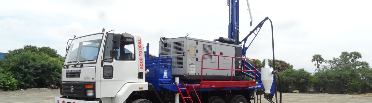
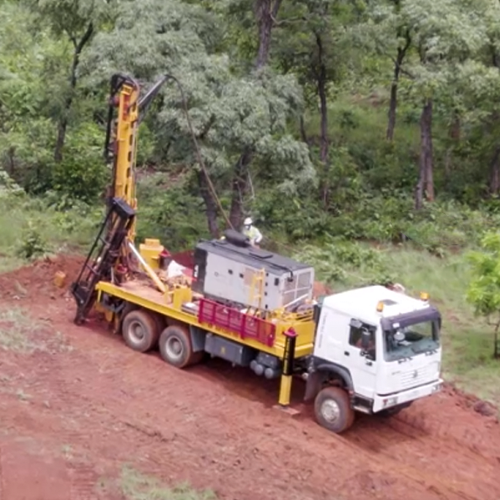
Core holes are drilled to document the sub-surface lithology, mineralisation, fault networks, porosity, permeability etc at different depth intervals. The core samples are brought up to surface and need to be preserved properly since it undergoes tremendous changes in pressure and temperature, which can result in volatiles escaping from the rock mass or some minerals to rapidly undergo alteration. A special drill bit is used for coring that excavates and preserves a tubular section of rock. Coring is slower and more expensive.
Exploration boreholes can be used for many purposes in the geothermal industry. They can provide critical information about the resource at depth allowing developers to better understand the potential power output from a particular area. Exploratory boreholes are also useful for existing geothermal power facilities interested in expanding their resource.
A hydro-probe is a relatively inexpensive and easily portable truck mounted drill rig that can reach up to 50 m depth. The drill rig pushes a 1 ½ inch hollow tube into the ground. This technology allows for a relatively quick and easy method for collecting samples and temperature measurements from up to 50 m depth.
Micro-hole array are a series of hundreds of small-diameter directional boreholes that can be drilled with diameters of less than 4”. A directional array is drilled from the primary wellbore in order to intersect natural or induced fractures in the reservoir, allowing fluids to access more surface area for more efficient heat mining of the geothermal resource. Multiple micro-holes allows a larger volume of rock to be accessed by working fluids via more flow paths, increases the probability of intersecting open fractures, and reduces ‘short circuiting’ of working fluids within the Enhanced Geothermal System reservoir. This results in more effective heat mining of hot rocks, lowering development risk and increasing the productive life of a project.
Slim holes are typically drilled using a diamond coated bit, core samples are often collected, and reservoir properties measured. Slim holes can range from 3-6’’ in diameter and be significantly cheaper than traditional wider rotary drilled holes.
A step-out well is a type of exploratory well drilled outside of the known reservoir to search for an extension of the reservoir or even a new nearby reservoir. They are used to find another productive zone within an already producing field, or to extend the parameters of the known field.
Thermal gradient holes are typically shallow holes that are drilled and surveyed with a temperature probe. Designing a drilling program that will maximize the information based on orientation of the reservoir and faults can reveal an abundance of information about the hydrogeology and thermal properties of the deeper hydrothermal system.
Mineral Exploration Process
The exploration becomes systematic when it follows a sequence of evaluation stages to assess the mineral potential of a location. Knowledge about the project is increased at every stage, and this knowledge serves as the basis whether to proceed with the project or not. Step by step procedure in exploration activities is required to quantify the mineralization, to define the shape, size and metal content of the de-posit and to decide whether to continue with the exploration or to abandon it.
The first stage is to decide on the exploration strategy, whether to start exploring from known resources, such as identifying a mineral belt and start exploring from its outskirts or to start exploring at unknown but potential locations and gather information from it.
The second stage is one of prospecting, that is when we set foot on the ground to explore and search for indicator minerals. The property containing a deposit, called the ‘prospect’, is explored to determine some of the more important characteristics of the deposit, its quality and quantity, size, shape, orientation in space etc using both geo-physical as well as geo-chemical prospecting. If the area is large, aerial or satellite imagery provides one means of quick examination. On the basis of such studies, a number of prospects are identified. The most promising of these becomes the focus of a field exploration program.
Once this is done, the next stage is to ramp up exploration efforts using existing maps and historical data, geophysics, ground truthing, geochemistry, and trenching to try and identify drill targets. The more the data in-hand, more would be the confidence to go for production drilling. In order to facilitate this and de-risk the project, it is better to use more exploration tools like metallurgical tests, environmental assessments, 3d models, and mine designs to get a clear picture of the resources available underground. Once enough information is collected, an official resource estimate would then follow culminating in the final feasibility report, leading to a production decision followed by construction of mine and start of commercial production. If, however, more data is required for a decision, the cycle would repeat.
Modern exploratory Methods
A number of methods have evolved over the last decade making the exploratory process much more accurate and less time consuming. Remote sensing, for example, provides higher resolution satellite imagery data for well-planned exploration programs. Presently the best imagery is available here in India from NRSA (The National Remote Sensing Agency)- the IRS series of satellites, and with the launch of the Earthwatch – Quickbird series of satellites in the USA, the stage in all set for a revolution in the procurement and use of submeter imagery in the commercial world.
Depending on the purpose of exploration there are a number of airborne techniques used for determining possible target zones and more often cutting exploration costs drastically by narrowing down the area to be covered by detailed ground geophysical studies. The basic concept remaining the same, which collecting data from equipment aboard a low-flying (80m above ground) aircraft at small line intervals. The Orissa State has collected a digital data base covering 75,000 sq. kms. and incorporating, High-resolution Aero-magnetics, radio-metrics, digital elevation, satellite imagery, and topographical data all collected and collected at 1:50,000 scale. By drilling only those areas showing a high potential, an effective exploration program can be carried out less expensively. While satellite imagery maps only the superficial ground cover, high-resolution aeromagnetic maps the unseen or below-surface lithology, actual depth depending on the terrain constituents.
It is important to mention that your data is only as good as the methodology and techniques used to gather this information. Data collected from a height of 500 or 1000 m with line spacing of half a kilometer will be of little use to the industry when compared to data collected form a height of 80m with 200m line spacing.
Summary
Drilling is one of the most important and can be the most expensive, of all mineral exploration procedures. In almost all cases, it is drilling that locates and defines economic mineralization, and drilling provides the ultimate test for all the ideas, theories and predictions that are generated in the preceding prospect generation and target generation phases of the exploration process. While exploration has never been as challenging as it is today, advances in technology have meant that the most arduous and repetitive tasks of drilling can be confidently overcome – largely thanks to the rapid progress of advanced control systems and automation.